A bulla of Hezekiah of Judah. It reads “Belonging to Hezekiah [son of] Ahaz king of Judah
It was recently announced that a clay bulla of Hezekiah King of Judah (727-698 B.C.) was discovered during excavations in the Ophel area of Jerusalem. Although found in 2009, the discovery has only recently been made known to the public. While previous bullae (plural of “bulla”) of Hezekiah are known, this is the first one discovered in an archaeological context (others have appeared on the antiquites market and in the collections of antiquities dealers). A bulla is a small piece of clay, which has been impressed by the owner’s seal. Bullae were used to seal papyrus documents that were rolled and tied with a string (see picture below). In the middle of the bulla of Hezekiah is a picture of a two-winged sun disk. The wings of the sun disk point downward and it has six rays of light projecting from it (3 from the top and 3 from the bottom). On either side of the sun disk (the one on the right is most clearly visible) are ankh symbols from Egypt known as “the key of life.”
Example of an ancient papyrus (from the 5th century B.C.) still rolled and tied with strings. The back of the bulla shows the imprint of the papyrus grain. Image taken from http://www.archaeological-center.com/en/monographs/m13/
Given Israel’s aversion to symbols, especially by a King known for his sweeping religious reforms (2 Kgs. 18:1-6; 2 Chron. 29), it is somewhat surprising to find this iconography on King Hezekiah’s seal. The use of Egyptian symbols may also surprise many. As far as current knowledge tells us, Hezekiah seems to be the first king of Judah to use a royal emblem with an icon on it. It is also known from other bullae that Hezekiah adopted the use of the two-winged scarab (dung beetle), known in both Egypt and Phoenicia. Thus, we are now aware of two different images that were employed on the royal seals of Hezekiah. There are several passages which suggest a dependence on Egypt by Hezekiah, and this may be why the king’s seals show Egyptian influence. For example, when Sennacherib is laying siege to Jerusalem, the Rabshakeh (an Assyrian official) rebukes Hezekiah for trusting in Egypt (Isa. 36:4-6). Although Hezekiah is not specifically mentioned in Isaiah 30, this passage condemns Judah’s leadership for trusting in Egypt for military aid. As far as the imagery on the seal itself, given Hezekiah’s aversion to idolatry, Robert Deutsch’s conclusion seems correct. He states, “Although winged sun disks and scarabs had originated in foreign lands, by the eighth and seventh centuries BCE, when they appeared on Hebrew seals, they were already quite old and bereft of any religious significance. They were used solely for their decorative value and their connotation of power – and should be regarded as Israelite/Judahite. When Hezekiah adopted the two-winged scarab and the two-winged sun disk with six rays as royal emblems, he was simply appropriating generally accepted icons of royal power and not importing meaning from either Phoenicia or Egypt” (Lasting Impressions: New Bullae Reveal Egyptian-Style Emblems on Judah’s Royal Seals–the whole article is worth reading).
The Bulla of Hezekiah and the Ophel
The bulla of Hezekiah was found in the Ophel which is the area circled in the photo above..
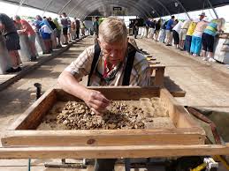
As noted above, the bulla of Hezekiah was discovered during excavations of the Ophel in Jerusalem. The Ophel is the area between the Temple Mount and the City of David (see the picture on the right). The bulla was found in an ancient refuse dump near a royal building that dates back to Solomon’s time (mid-tenth century B.C.). I had the opportunity of exploring this area last Spring (2015). The bulla was discovered through a process known as wet-sifting. Wet-sifting is a process utilized by Dr. Gabriel Barkai and Zachi Dvira at the Temple Mount ever since the illegal dumping of tons of soil bull-dozed on the Temple Mount in 1999 by the Waqf. These archaeologists realized that “this discarded earth represented a treasure trove of information relating to the Temple Mount’s history” (see Temple Mount Sifting Project). Since Barkai and Dvira implemented this system of searching through the dug up soil, it has become a staple of archaeological excavations. Many smaller items, like this bulla of Hezekiah, would easily go undiscovered if this method were not employed.
Wet-sifting continues at the Temple Mount and thousands of volunteers participate each year.
Well known Israeli archaeologist Dr. Eilat Mazar was in charge of the excavations at the Ophel. You can watch a very interesting video here showing Dr. Mazar’s explanation of the discovery, and of the bulla of Hezekiah. The same video with an accompanying article can be found at phys.org. The bulla of Hezekiah is not only one of several bullae that exist of the Judean King, it is also one among a number of other bullae that have been discovered that refer to people mentioned in the Bible. Bullae of several of Hezekiah’s court officials have also been discovered (see the link to Deutsch’s article above). We also have a seal impression of King Ahaz, the father of Hezekiah, as well as several Judean officials from the time of Jeremiah. Whether archaeological discoveries in Israel are big or small, they continue to help us better understand the ancient world of the Bible.
After Saul was killed in battle against the Philistines (1 Sam. 31), his army captain Abner took Saul’s son, Ish-bosheth (Ishbaal) and made him king (2 Sam. 2:8-10). As I discuss in my book Family Portraits, Ish-bosheth is also known by the names Ishbaal and Eshbaal in the Bible (1 Chron. 8:33; 9:39). It has recently been announced that in the summer excavations of 2012 at Khirbet Qeiyafa (see my article on Khirbet Qeiyafa), a large stone storage jar (pithos) was discovered with the name Ishbaal / Eshbaal inscribed on it.
One of the latest finds at Khirbet Qeiyafa is an inscription with the name Ishbaal. (map taken from holylandphotos.org)
This discovery has several interesting features. For starters, this is the first time that the name Ishbaal has been found outside of the Bible. Second, the layer in which the Ishbaal inscription was found dates to the period of 1020-980 B.C., according to radiometric dating. This is precisely the time period in which Saul’s son, Ishbaal would have been active. This Ishbaal, however, is not the son of Saul. We know that because the inscription goes on to read, “son of Bedaʿ.” The name Bedaʿ is unique, not being found in the Bible or in an archaeological context before. According to the authors of a recent article in BASOR (Bulletin of American Schools of Oriental Research) announcing this discovery, “The letters of the inscription are large and clear, similar in size and evenly spaced, and were written by a skilled hand in Canaanite script” (see the full article here). The inscription is the result of a skilled scribe and thus suggests the presence of a developed society. The fact that this inscription is Canaanite is of special interest to paleographers (those who study ancient scripts). Originally it was thought that the Canaanite script was replaced by the so-called Phoenician script at the end of the second millennium B.C. Now we have evidence of the Canaanite script being in use during the monarchy of David thanks to this discovery, along with four other inscriptions (2 more from Khirbet Qeiyafa, 1 from Beth Shemesh, and 1 from Jerusalem).
A bronze statue of Baal discovered at Ugarit from the 14th-12th centuries B.C.
Baʿal is the name of the Canaanite storm god and was often attached to names just as God (el) orYahweh (yahu, usually spelled with “iah” in English) was. This practice is called using a “theophoric” element, which simply means that the name of the god is embedded in a person’s name. What is interesting about the use of “baal” as a theophoric element in names is that the Bible shows no evidence of its use after the early monarchic period (10th century B.C.). Previous to, and including the early monarchic period, it is found in names like Jerubaal (Gideon’s other name), Meribbaal (Jonathan’s son, also called Mephibosheth), and, of course, Ishbaal. Archaeology reflects the same practice. No inscription has ever been found in Judah from the 9th – 6th centuries with “baal” used as a theophoric element. While Baʿal means “lord” or “master,” its association with the Canaanite god seems to have made it an unpopular name in Judah during those centuries.
There is still one more inscription from Khirbet Qeiyafa yet to be translated. It will be interesting to see what further light it might shed on this period of history.
In Secrets of Jerusalem’s Temple Mount, Leen Ritmeyer reveals the location of the Temple.
Where exactly was the Temple located on the Temple Mount? There are several popular theories regarding the exact location of the ancient Temple in Jerusalem. Many believe that it was built in the same area where the present Dome of the Rock now stands. Another popular theory suggests that it stood over the Dome of the Tablets, a small shrine to the northwest of the Dome of the Rock. Still yet, another theory proposes that it was built between the Dome of the Rock and the Al-Aqsa mosque. Since it is impossible to do any excavation on the Temple Mount (although see the recent article at ritmeyer.com “Illegally Digging Up the Temple Mount”), is it possible to determine the Temple’s location? In Secrets of Jerusalem’s Temple Mount, Leen Ritmeyer, an expert with over 40 years of experience involving excavations and research on the Temple Mount, reveals his understanding of the exact location of the Temples of Solomon and Herod, including the location of the Holy of Holies. From 1973 to 1977 Ritmeyer was chief architect of the Temple Mount excavations directed by Benjamin Mazar. From 1978 to 1983 he was field architect of the Jewish Quarter excavations of the Old City of Jerusalem headed by Professor Nahman Avigad. Since that time Ritmeyer has continued his research on the Temple Mount, even writing his doctoral dissertation on “The Architectural Development of the Temple Mount in Jerusalem.” These qualifications make him an expert worth listening to.
Secret’s of Jerusalem’s Temple Mount: Contents
Secrets of Jerusalem’s Temple Mount: Updated and Enlarged Edition is available at Amazon USA / UK as well as the Biblical Archaeology Society.
Ritmeyer bases the conclusions in his book on ancient accounts such as Josephus and especially Middot (a portion of the Mishnah written around 200 A.D.). He also relies on archaeological evidence from recent excavations, as well as the pioneering work of Charles Warren who, in the 1860s, was able to dig various shafts and tunnels around the Temple Mount and explore underground areas no longer accessible due to the modern political situation. Warren and his team left very detailed accounts of their findings as well as some artistic drawings. The Contents of Secrets of Jerusalem’s Temple Mount are as follows:
1. “A Tour of the Temple Mount with Herod the Great,” is a fictionalized account written by Kathleen Ritmeyer, Leen’s wife, based on historical information of the period. The purpose is to provide the reader with some historical background in an entertaining way.
2. “Reconstructing Herod’s Temple Mount in Jerusalem.” This chapter gives a detailed description of what Herod’s Temple Mount Complex would have looked like. It includes photos, diagrams, and drawings of various aspects of the Temple Mount, including a drawing of what Ritmeyer believes Herod’s Temple Mount would have looked like.
3. “Quarrying and Transporting Stones for Herod’s Temple Mount,” is a short chapter that looks at the methods which would have been employed in cutting and preparing the stones, as well as how these massive stones were moved into place. One technique of moving the stones overlooked by Ritmeyer is attaching wheels to the stones so that they could be rolled to the site.
This diagram shows the size and position of Solomon’s Temple Mount, according to Ritmeyer in his book, Secrets of Jerusalem’s Temple Mount. It also shows how it was expanded by the Hasmoneans and Herod.
4. “Reconstructing the Triple Gate.” In my times in Israel, I have heard some speculate that the Triple Gate and Double Gate at the top of the southern steps were for exiting and entering the Temple Mount. Ritmeyer, however, argues that the Triple Gate was only used by the priests and led to a large storage area. The Double Gate, on the other hand was used for visitors and had a very broad staircase (210 feet) that would have accommodated people entering and exiting. By contrast, the staircase in the Triple Gate is only 50 feet wide (p. 61).
5. Chapter 5, “Locating the Original Temple Mount,” is an indepth discussion which includes many helpful drawings and diagrams explaining Ritmeyer’s conclusions on where the original platform on which Solomon’s Temple was located. I have included one of those diagrams here which shows the position and dimensions of the original Temple Mount, according to Ritmeyer.
This diagram shows Ritmeyer’s understanding of where the walls of the Holy of Holies would have been. The red rectangle marks the depression where the Ark would have set and is right in the center of the Holy of Holies. (Secrets of Jerusalem’s Temple Mount, p. 109).
6 & 7. Chapters 6 & 7 go together establishing Ritmeyer’s view on where the Holy of Holies was located and where the Ark of the Covenant rested. They are entitled respectively, “The Ark of the Covenant: Where It Stood in Solomon’s Temple,” and “Mark of the Ark Confirmed by Modern Technology.” Ritmeyer is convinced that the Ark rested in a rectangular depression on the es-Sakhra. The es-Sakhra is the highest point on the Temple Mount and lies exposed in the Dome of the Rock. Muslims believe it is the place where Mohammed ascended into heaven. Although some quarrying was done on this rock when the Crusaders briefly held it and turned the Dome of the Rock into a Christian Church (12th century), Ritmeyer argues that the area where the Ark rested has been preserved. He argues that the rectangular depression is just large enough for the Ark and a copy of the Law to lay before it. The depression is angled so that the longer side of the rectangle faces east-west. At first this puzzled Ritmeyer, but he notes that it agrees with the evidence found in 1 Kings 8:8 and with what the Talmud says about the length of the poles used to carry the Ark (pp. 117-118).
8. “The Structure of Herod’s Temple: Why We Can Rely on the Description in Middot,” is Ritmeyer’s defense of why this description in the Mishnah is the most reliable source. This chapter also goes into detail regarding the various sections of the Temple complex in the time of Herod such as the Women’s Court, the Court of the Israelites and Court of the Priests, etc., and includes another nice diagram of this area. Page 144 also includes a 3-D cut-away drawing of Herod’s Temple.
9. “What Did Solomon’s Temple Look Like,” is the final chapter in Secrets of Jerusalem’s Temple Mount. Ritmeyer states, “It is not difficult to draw a plan of Solomon’s Temple from its description in 1 Kings 6 and 7; it is much more difficult to draw a section through the building–to envision, in other words, what the building would have looked like if we sliced through it like a cake and looked at the inside” (p. 153). Ritmeyer says that the two biggest obstacles he faced in understanding the design of Solomon’s Temple was the difference in size between the Holy Place and the Holy of Holies (30 cubits high as compared to 20), and the relationship of the two bronze pillars (named Jachin and Boaz) to the Temple itself. Regarding the height difference, many have suggested that there was an upper chamber of 10 cubits above the Holy of Holies or that the Holy of Holies stood 10 cubits higher than the Holy Place. However, Ritmeyer notes that if es-Sakhra is the location of the Holy of Holies, it stands 5 cubits higher than its surroundings. Given this information, Ritmeyer believes that there was a natural rock ramp that led up into the Holy of Holies from the Holy Place and that the roof of the Holy of Holies was 5 cubits lower than that of the Holy Place (p. 155). Concerning the bronze pillars, Ritmeyer notes that there is no evidence that they were freestanding, apart from the porch of the Temple, as found in some reconstructions. In every case in the ancient world, the pillars of a temple supported the porch. While conducting this research, Ritmeyer was requested to construct a model of Solomon’s Temple. He states that this request caused him to scrutinize the text of 1 Kings 6-7 even more carefully and led to a deeper understanding of Solomon’s building. His model can be seen below.
Ritmeyer’s model of Solomon’s Temple.
Secrets of Jerusalem’s Temple Mount: Evaluation
I have always leaned toward believing that the Temple originally stood on the site of the Dome of the Rock. First, temples were usually constructed on the highest point of a mountain. Second, once a place was considered holy in the ancient world, it usually stayed holy unless somehow desecrated. Since es-Sakhra is the highest point on the mountain, it makes sense this is where Solomon would have built the Temple. It also makes sense that Zerubbabel, and later Herod would have rebuilt the Second Temple on the same spot. It’s hard to imagine that Jews would have accepted moving the Holy of Holies to a different location, or any other part of the sacred structure. This is one reason I have never favored any of the other theories that have been proposed. Ritmeyer’s experience and study of the Temple Mount, and his indepth arguments have only served to strengthen my belief. Furthermore, Secrets of Jerusalem’s Temple Mount, taught me many other details that I had no knowledge of. Even though this book is written for a general audience it is very detailed and technical and therefore it may not appeal to everyone. But for those who are interested in the Temples of Solomon and Herod, their significance, where they stood, and what they looked like, Secrets of Jerusalem’s Temple Mount is a goldmine of information. I highly recommend it!
For further information on the Temple Mount, including video presentations, go to http://templemount.org/
Seeing the City of David has become a more pleasant and informative experience over the years. Here is a view of the entrance.
The first time I travelled to Israel was in 2005 on a tour with my church from Calvary Chapel York. I had anticipated coming to Israel all my life. When I was younger I wanted to study at the Hebrew University. Unfortunately, those plans never materialized. In 2000 my home church in the states planned a trip and Gloria and I were going, but the Intifada cancelled our plans. Needless to say, by 2005 (our next opportunity to go) I was chomping at the bit, and tops on my list was seeing the City of David. Imagine my disappointment when I discovered that a tour of the City of David wasn’t even on our list of sites to see! Seeing the City of David would have to wait until my next visit in 2006. As evidenced by my first tour in 2005, the City of David has not always been considered a “must see” site. But things have changed dramatically in the past 10 years. Archaeological excavations have continued to uncover dramatic finds, such as what some believe to be David’s palace (known as the “Large Stone Strucuture”), and the Canaanite tower that protected Jerusalem’s main water supply–the Gihon Spring.
On my recent visit (2015), I was impressed how seeing the City of David is becoming a more enjoyable and tourist-friendly experience. I was fortunate enough to visit Israel in 2005, twice in 2006 and again in 2007, 2008, and 2009. However, my current visit in February-March of 2015 was my first time back in 6 years. As everyone who is interested in Israel and the Bible knows, new discoveries are constantly being made. But one of the things that impresses me is how Israel continues to develop many of its sites, like the City of David, and make it a more informative and pleasant experience. This post is about the changes I have noticed between my earlier visits to the City of David, and my recent visit in 2015, as well as things you can expect to see and experience at the City of David.
Seeing the City of David: The Large Stone Structure
When seeing the City of David in 2006, one could look down through some boards to see the excavation of the Large Stone Structure in progress.
When I first visited the City of David in March 2006, Eilat Mazar was only a year into excavating what she, and others, now believe to be David’s palace. Today as you enter the City of David, you descend a few stairs to a platform that houses a ticket office, gift shop, bathrooms, and a small store. Underneath the platform are the results of Mazar’s excavation which can be accessed by a stairway that takes you down to the “Large Stone Structure.” Obviously, none of this was there when I first visited the City of David in 2006. Above is a photo I took of the excavation that was then in progress.
A reproduction of the Proto-Aeolic capital discovered by Kenyon. Such capitals are known to have adorned palaces and governmental buildings of the 1st Temple Period.
Today, not only can you descend the stairs to see the Large Stone Structure (which was also possible in some of my earlier trips), but there is a display of a few other significant findings. One of the most significant is an ornate Proto-Aeolic capital (The one at the site is a reproduction. The original is in the Israel Museum.). This capital was not found by Mazar, but by Kathleen Kenyon years earlier. However, it was one of the pieces of evidence that led Mazar to believe there was an Israelite palace in the area she ended up excavating. The result, of course, was the uncovering of the Large Stone Structure. Archaeologists are still debating whether this building dates to 1200 B.C. and, thus, to the Jebusite occupation, or to 1000 B.C. to the time of David. Either way it is clearly an old building and an important one.
Clay bullae discovered in the Large Stone Structure with names of individuals mentioned in the Book of Jeremiah.
Further confirmation of the significance of this building occurred with the discovery of two bullae that are from ministers in the court of King Zedekiah (the last King of Judah). Horovitz (City of David: The Story of Ancient Jerusalem) gives the following details: “The ‘Large Stone Structure’ remained standing until the Babylonian destruction of the First Temple in 586 B.C.E., as proven by pottery from the sixth century B.C.E. discovered at the site. A surprising find amidst the structure’s large stones delineated the time-frame in which the structure was destroyed. This was a bulla, a clay seal impression used for sealing scrolled documents written on parchment or papyrus, belonging to a high-ranking minister of the last king of Judah, Zedekiah. The minister’s name was Jehucal the son of Shelemiah…” (p. 117). Jehucal is mentioned in Jeremiah 37:3. Another bulla was subsequently discovered with the name Gedaliahu the son of Pashhur, another individual in the court of Zedekiah who is also mentioned in the book of Jeremiah (Jer. 38:1).
Seeing the City of David: The Canaanite Tower
Seeing the City of David in ancient times would ahve involved seeing this protective structure around the Gihon Spring. This is an artist’s conception of the Spring Tower.
The newest, and most dramatically altered, area in the City of David since my last visit, is the presentation of the ancient Canaanite walls and tower that protected the Gihon Spring. Archaeologists Ronny Reich and Eli Shukron have been excavating this area (near the bottom of the eastern hill where the Gihon Spring bubbles to the surface) since 1995. Over the years, as I observed this excavation I was excited about what would be learned. The Gihon was the main water source of ancient Jerusalem, but it is situated in a difficult place for an ancient city. For the protection of the city, the walls had to be built higher up the slope, but this meant the Gihon was exposed. This is fine during peaceful times, but during times of siege, this was a great problem. Along with tunnels carved out of the rock, the Canaanites built a large tower that came out from the city walls and enclosed the Gihon. This tower is usually called the “Spring Tower,” or “Pool Tower.” The drawing in the upper right is one artist’s conception of what the Spring Tower may have looked like.
The Spring Tower area. My visit in 2006.
What impressed me the most on my recent visit was how the vicinity around the Spring Tower has been transformed into a tourist friendly, and more informative area, than in my past visits. There are now two movies that run offering explanations of the area in Canaanite times and later, as well as offering visuals of what the Tower would have looked like.
This photo from the Ir David Foundation shows a stairway in the back, as well as a walkway that takes you around the ruins of the ancient Canaanite walls.Here is another view (courtesy of bibleplaces.com) of the way it looks today.
This tunnel was the ancient drainage system that led from the Temple Mount down to the Pool of Siloam. Many Jews tried escaping through this tunnel when the Romans destroyed Jerusalem in 70 AD. That’s my wife Gloria bravely leading the way!
Of course a must on anyone’s list when seeing the City of David is Hezekiah’s tunnel. Hezekiah’s tunnel is the next stop after the Canaanite Tower. Exiting the tunnel brings one out at the steps of the ancient Pool of Siloam (John 9:7). One of the other new attractions that was not available on my last trip in 2009 is the tunnel that can be followed underneath the City of David, leading one all the way up to the base of the Temple Mount. There are actually two tunnels. The entrance to both is just outside Hezekiah’s tunnel. One tunnel shows the ancient street that existed in the time of Jesus that led from the Siloam Pool all the way to the Temple Mount. However, only a small portion of this street has been excavated. If you want to go all the way to the Temple Mount, you must enter the second tunnel which is actually a drainage system that goes underneath the ancient street. Our guide jokingly referred to it as the “sewer tour,” which is, in fact, what its purpose was in the 1st century.
These tombs are believed to be the tombs of the Judean Kings, with the one on the left being identified by some as the possible tomb of David.
Besides exiting through Hezekiah’s tunnel, one can also opt to take the “dry” tunnel (which is an ancient Canaanite tunnel–I know, yet another tunnel!). The exit from the Canaanite tunnel actually brings you out in the middle of the ancient city near some of the ancient walls on the eastern slope of Jerusalem. A little further down the slope you can see the remains of what is believed to be the tombs of the Judean kings. One is even speculated to be King David’s tomb.
If you’ve never been to the City of David, hopefully this brief post will whet your appetite for seeing its many interesting discoveries. If you’ve been to the City of David, but it has been a few years, I think you’ll be as pleasantly surprised as I was about the continuing progress being made regarding both new discoveries and the tourist-friendly environment.
(For those who would like more information on the City of David, I have included a few links below that I have found helpful.)
The following post is based on my visit to Tel Beersheba on March 2, 2015.
Tel Beersheba: Location
This map shows the Negev region in Israel. Tel Beersheba can be found near the center of the map.
Tel-Beersheba is located in the northern Negev (“Negev” meaning “South,” so the southern area of Israel) east of the modern city of Beersheba. Tel Beersheba is situated in the heart of the Beersheba Valley, an area with rich soil for cultivation. However, the valley sits near the edge of the desert and receives little rainfall. Beersheba is, of course, famous in the Bible as one of the places where Abraham and Isaac stayed (Gen. 21:22-34; 26:15-33), although Tel-Beersheba did not exist in their day. There are many other ancient sites in the area, even some buried beneath the modern city of Beersheba, and it is probably one or more of these sites that would have existed in the time of Abraham and Isaac (some scholars think that a site known as Bir es-Saba’ may be the site of the patriarchs).
The New Encyclopedia of Archaeological Excavations in the Holy Land. There are currently 5 vols. available.
The Negev region around Tel Beersheba is more hilly than I expected, and I learned that the Tel sits on a hill that overlooks the Beersheba and Hebron valleys. “The city that developed at Tel Beersheba is located at an important crossroad: Mount Hebron in the north; to the Judean Desert and the Dead Sea in the east; to the Coastal Plain in the west; and to the Negev hills, Kadesh-Barnea and Elath in the south” (Ze’ev Herzog, The New Encyclopedia of Archaeological Excavations in the Holy Land, vol. 1, ed. Ephraim Stern, 1993, pp. 167-173–some of the information from this post comes from this source, see photo on the left). In biblical times, Beersheba, which was alloted to the tribe of Simeon (Josh. 19:1-2), was known for being the southern boundary of Israel. “From Dan to Beersheba,” is a well-known expression in the Old Testament (e.g., Judg. 20:1; 1 Sam. 3:20; 2 Sam. 3:10) describing the entire land from north to south.
Tel Beersheba consists of 9 different layers (or strata). It was originally inhabited in the 4th millenium B.C., but was then abandoned for 2,000 years and only resettled during the beginning of the Iron Age (for Old Testament readers, this is the period of the Judges and dates from 1200-1000 B.C.). The city was continuously inhabited for about 500 years and experienced a violent destruction, probably at the hands of the Assyrian King Sennacherib in 701 B.C. Sennacherib boasts to have destroyed 46 fortified cities in Judah and left Judah’s King Hezekiah “like a bird in a cage” inside Jerusalem. The first four strata (IX-VI) date to the Judges era. The city was not fortified early on and consisted of simple dwellings with houses gradually appearing in later layers. Stratum VIII shows evidence of the first houses and it is suggested that these houses mark the progress toward a permanent settlement and may reflect the time period of Joel and Abijah, the sons of Samuel, who were appointed judges in Beersheba (1 Sam. 8:1-2).
This photo shows a storage room to the right of the main gate of the city upon entering. Notice the line (center wall) that separates the original walls from the reconstruction.
The time period most clearly reflected at Tel Beersheba is what is known as Iron Age II–specifically, 1000-700 B.C., the time of the united kingdom (David and Solomon), through the time of Hezekiah (the Judean monarchy). This consists of Stratum V-II, but it is particularly Stratum II (which represents the final destruction stage) that is most apparent. The city was clearly laid out according to a plan and I was struck by the fact that Tel Beersheba allows you to picture what a small fortified city in Judah would have looked like. The gate, houses, governmental buildings, and the streets have all been uncovered. In fact, the original excavation (led by the well-known Israeli archaeologist Y. Aharoni from 1969-1975) took great care to not only preserve the original walls, but also to rebuild part of the walls with the original material. The reconstructed area can be seen today by a line that marks the original from the reconstruction (see my photo at right).
A modern tower has been constructed at Tel Beersheba that allows one a wonderful view of the layout of the city. The following photos show the city from left to right from the vantage point of the tower.
Tel BeershebaThis view of Tel Beersheba shows the city square ( upper middle to right of the photo). The “governor’s palace is just to the left of the city square.This view of Tel Beersheba shows the city gate (upper middle) and the storage room to the left of the gate.
Tel Beersheba: Important Discoveries
The 4-horned altar from Tel Beersheba which is now located in the Israel Museum.
One of the interesting discoveries at Tel Beersheba was of a four-horned altar. This altar helps to confirm that Beersheba had a “high place.” Aharoni (the original excavator) believed that it provided proof of a temple in the city (similar to Arad, click here to read my article on the temple at Arad). The parts of the altar were found incorporated into one of the storehouse walls (see photo of storehouse above), which suggests it was dismantled during the cultic reform carried out by Hezekiah (2 Kings 18:1-6). The prophet Amos denounces those who worship at Beersheba (Amos 8:14). He compares it to the “sin of Samaria” and the false temple at Dan (see my article on Tel Dan here), which may suggest that Aharoni was right about an actual temple existing in Beersheba.
I am standing in a typical Israelite 4-room house at Tel Beersheba.
Although 4-room houses are not an unusual discovery–they were the common Israelite house of the First Temple period–I was surprised how many were uncovered at Tel-Beersheba. The photo at the right shows me standing in a typical 4-room house. These houses consisted of 3 parallel rooms with one long room against the back of the house. Based on the housing available, estimates of the population of Tel Beersheba are small. The inhabitants appear to have numbered no more than 300-400. The reason for this, however, is because it was a special admistrative and defensive city. Therefore, the city consisted of officials, soldiers, and their families.
My friend and host in Beersheba, Howard Bass, standing in the governor’s palace.
The most impressive building at Tel Beersheba is what is referred to as “the governor’s palace.” This is the building that was used by the commanders of the city and (as noted in the photo above) it is situated near the city square. This building consisted of 3 large reception halls, plus two dwelling units, and a kitchen and storeroom. Down the street is another large structure called the “Basement House.” The special characteristics of this building caused Aharoni to suggest that this was the area where the temple in Beersheba had originally stood. All of the rooms of this building had their foundations dug down to bedrock and the space between the rooms was filled with earth. This could have been the result of Hezekiah’s destruction of the temple at Tel Beersheba.
Bible Walks has helpfully provided a plan of the city, showing it’s significant structures. The basement house can be found in the upper corner in blue, while the governor’s palace is in yellow at the bottom left. For more info go to http://www.biblewalks.com/Sites/TelBeerSheba.htmlThis photo also from biblewalks.com provides a nice overview of some of the important places at Tel Beersheba.
The water system at Tel Beersheba is also very impressive. Besides the ancient well that sits in front of the city gate (dated to about 1200 B.C.), there is a huge reservoir than can be accessed by going down a long stairway and into a tunnel that has been carved out of the rock. This water system was excavated by Ze’ev Herzog between 1993-1995, who formerly worked with Aharoni and took over the excavation in 1976 after Aharoni died. The system, as is the case in other cities as well, was built to access the water supply during times of siege. It consists of three parts: 1) A shaft 17 meters deep with a flight of steps; 2) a reservoir hewn into the chalk rock and thickly plastered, divided into five spaces, with a total capacity of about 700 cubic meters; 3) a winding channel that led flood waters from the Hebron streambed into the reservoir (this information is taken from the brochure at Tel Beersheba). Below are a few photographs I have taken of this impressive system.
The shaft leading to the reservoir at Tel BeershebaThe entrance to the tunnel at the bottom of the shaft at Tel BeershebaOne of the reservoir compartments inside the tunnel at Tel Beersheba.
Finally, I’ll end my tour of Tel Beersheba where I probably should have started–at the gate of the city! The first photo shows the gate and the second shows the old well that sits out in front of the gate.
The city gate at Tel BeershebaThe old well near the gate at Tel Beersheba.
Tel Beersheba isn’t usually on the list of top spots to see in Israel. For one thing, it’s a bit out of the way, and for another, it can’t be identified with Abraham or Isaac. However, if you can sqeeze in a visit while you’re in Israel, I definitely believe it’s worth the time and the 15 shekel entry fee. It will give you one of the best views (if not the best) of the layout of an ancient Israelite fortress city. After all, Elijah stopped here (1 Kings 19:3), why shouldn’t you?
(All photos are my own unless otherwise noted. They may not be sold or used for commercial purposes, but they may be freely used for educational purposes)
![A bulla of Hezekiah of Judah. It reads "Belonging to Hezekiah [son of] Ahaz king of Judah](https://i0.wp.com/www.biblestudywithrandy.com/wp-content/uploads/2015/12/hezekiah-bulla-260x265.jpg?ssl=1)